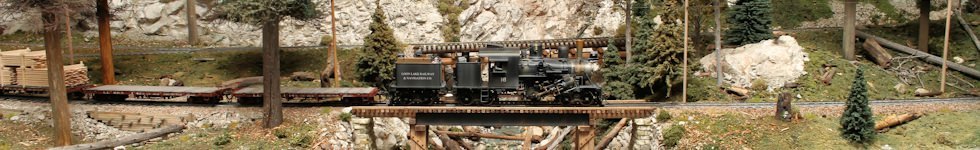
Your “Gateway to Model Railroading Fun”
The Gateway Division is the greater St. Louis area chapter of the National Model Railroad Association (NMRA), the largest organization devoted to the development, promotion, and enjoyment of the hobby of model railroading.
The Gateway Division includes St. Louis City and County, St. Charles and Jefferson Counties in Missouri, and Southern Illinois. We are a 501(c)(3) not-for-profit educational organization incorporated in the State of Missouri.
You are invited to visit any of our open-to-the-public monthly meetings, and we encourage you to attend our next Annual Fall Meet and Train Show, which includes a Model and Photo Contest.
We offer the following benefits:
- Education: We have monthly clinics on various model railroading topics. We have an annual fall meet and train show which includes dozens of clinics for members and the public. Our quarterly publication, the RPO, and web site includes articles and modeling tips.
- Fellowship: A variety of events and meetings allow area modelers to meet, interact, and share ideas and the fun of model railroading. Monthly meetings alternate between a St. Louis county and an Illinois location so that as many area modelers as possible have an opportunity to attend. We are not a club with a model railroad to support and promote. We have members modeling and interested in all scales, of all experience levels, and building and running all kinds of layouts (including club, home, garden, high-rail, and future layouts).
- Promotion of the hobby: We have a booth at most area train shows to promote the hobby and the NMRA, and to answer modeler’s questions.
- Advancement of your skills: Our members can help you improve your modeling skills and enjoyment of the hobby. The NMRA achievement program, merit award programs, and model contests offer a method to mark your progress. And our clinics and members will share techniques, methods and concepts you may have never seen or heard about before.
Gateway Division NMRA Officers
Superintendent (President): Jimmy Ables
Assistant Superintendent (Vice President): Dan Knipp
Clerk (Secretary): Jeffery Cooper
Paymaster (Treasurer): Bill Levin
Division Director: David Lowell
Board Member (Past-Superintendent): Willie Richter
Gateway Division NMRA Committee Chairs
Achievement Program (AP) Chairman: Dave Ackmann
Activities Chairman: Ron Gawedzinski
Membership Chairman: Bill Linson
Clinics Chairman: Dan Knipp
Fall Meet Chairman: Walter Beckman
IT Chairman: Willie Richter
Layout Tour Chairman: Dave Roeder
Publicity Chairman: Jimmy Ables
Operations Chairman: Greg Gramlich
Contest Chairman: Chris Oestreich
Webmaster: Richard Schumacher
